EVERY TWIST AND TURN – APALACHICOLA RIVER

BY JACKIE KOLK
WITH THANKS TO DAN TONSMEIRE, RIVERKEEPER EMERITUS
PHOTOGRAPHY BY H AROLD BRAMTON , MARY JESSICA FASICK,
ABBY EXNER, JAMES DANIELS, COURTNEY WARD, MAYA FASTHOFF
Hasn’t everyone heard of the Apalachicola Bay 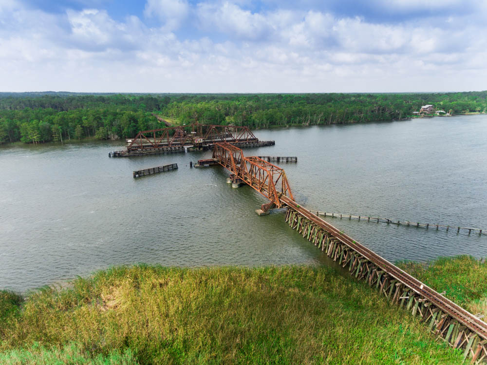 and its famous oysters? But what do we really know about the river and the waters that feed into the bay and provide just the right growing conditions for its oyster harvest? Have you ventured out on the Apalachicola River, exploring its twists and turns?
Former senator Bob Graham wrote the introduction to Clyde Butcher’s spectacular collection of photographs, “The Apalachicola River, An American Treasure,” and noted, “For its scale, diversity, and history, the Apalachicola River has persisted as one of America’s least-known great rivers. Under the shadow of anonymity, the Apalachicola has
been underappreciated.”
THE “BIG RIVER,” as locals call it, is formed by the Flint and Chattahoochee Rivers and runs south for about 106 miles. The Jim Woodruff Dam, built in the last century, produces hydroelectric energy for the surrounding areas. In this century, its ecological value became clearer after the river collapsed ecologically.
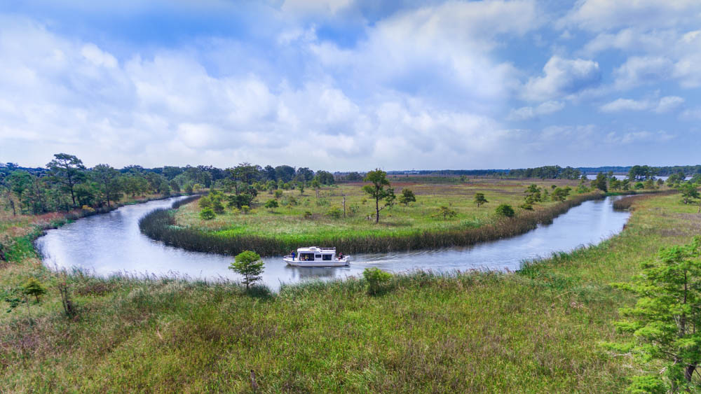
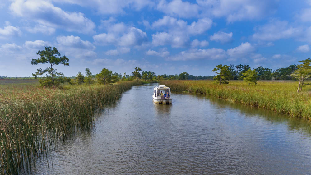
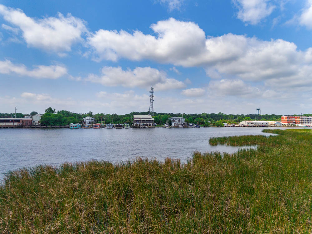
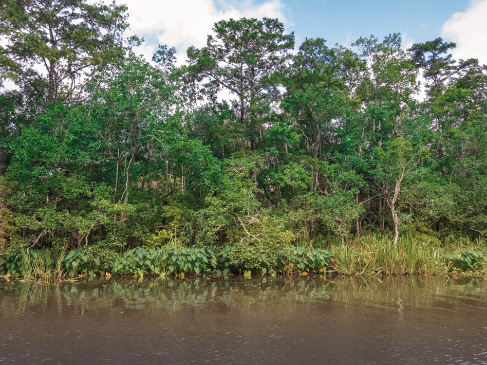
A boat ride on the River lets you discover nature and history – but you will need keen eyes for both. During my last excursion with local Riverboat Captain Gill Autrey, each bend of the River held surprises. We saw manatees far upriver. With no noises other than the low growl of the boat engine, it was peaceful, with the occasional flapping of wings, or splash of a fish that tried to escape a predator just beneath the surface of the brackish water. When we made yet another turn, an area known as Saul’s Creek stunned me with its dense foliage. It looked like we had entered the jungle of the Amazon. An anchored classic old wooden boat offered a tranquil sight when we entered a creek. Soon, we spotted an Indian mound across the marsh. The easy-to-miss elevated mounds are rare reminders of the native tribes that once populated the area. Locals report that the largest dugout canoe ever found was uncovered when a boat ramp was put in just north of downtown Apalachicola. 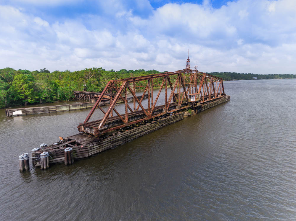 While traces of the original inhabitants are everywhere, you need to know what to look for to spot them. According to Faith Eidse’s “Voices of the Apalachicola,” over 50 Native American clans lived on the River or moved through the area. The Spanish are known to have traveled and settled the area by the year 1528. In “Outposts on the Gulf,” author William Warren Rogers reports that none of the over 50 Spanish missions in Florida were anywhere near the mouth of the River. When the British obtained the area from Spain in 1763, the Apalachicola River formed the boundary line between Britain’s East Florida and Spain’s West Florida. England then returned Florida to Spain in the 1780s. Spain ceded it to the United States by treaty in 1819. The town that became Apalachicola seems to have appeared in the early 1820s and took its name from the Lower Creek Apalachicola Indians who lived in the area. The first major survey of the Apalachicola, Chattahoochee, and Flint Rivers in 1828 showed the water was navigable year round at a depth of 6’5” from Apalachicola to Aspalaga Landing, a few miles down from the Chattahoochee River. Boats drawing less than 3.5 ft. could get to Columbus, Georgia most of the year. (Tonsmeire, “A Short History”.) In the 1820s, riverboats started plying the Apalachicola. There are isolated reports of wrecked riverboats being sighted in recent years. The riverboats first transported cotton.
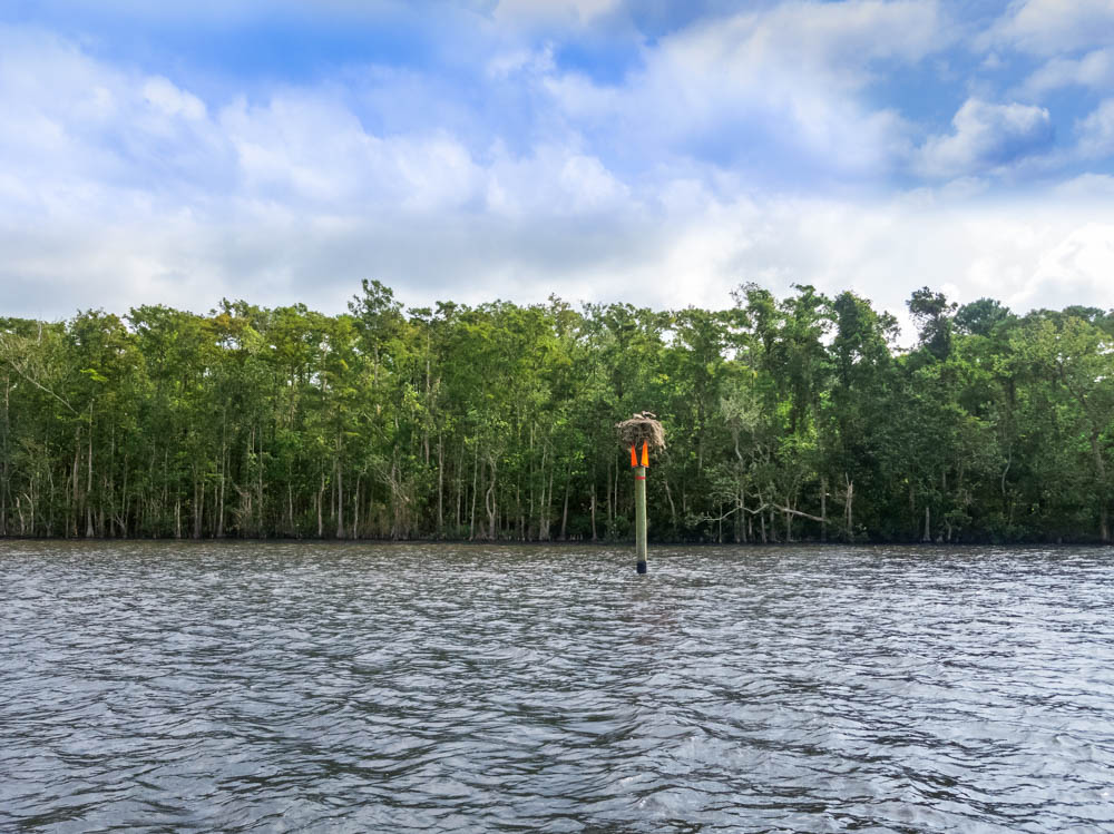
 By the early 1900s, lumber was the most important cargo. In those times, steamboats hosted elegant parties and river trips. The Apalachicola Northern Railroad was incorporated in 1903. Its first train rolled over the bridge across the Apalachicola River in 1907. After World War II, the drawbridge was rebuilt by the Railroad to increase inbound traffic of pulpwood and chemicals. (Turner, “Florida Railroad History.”) It still surprises me when the railroad bridge is just ahead and you thought you were deep in the wilderness. The River looks peaceful yet, for decades, there have been fights over the rights of control of it. In the 19th century, the nearby city of St. Joseph wanted steamboats coming down the Apalachicola River to turn off at the Jackson River to siphon traffic to St. Joseph’s port, circumventing the town of Apalachicola. Over the years, dredging to keep a channel open on the Apalachicola, Flint, and Chattahoochee River System has caused its own problems. As a direct result of reduced river flows from diversion of fresh water or drought, in 2012 Apalachicola Bay collapsed ecologically. The harvest of oysters, shrimp, blue crabs, flounder, and other fish in Florida was severely impacted. Assessments by the University of Florida’s Oyster Recovery Taskforce and the Florida Fish and Wildlife Conservation Commission documented the cause of the decline as lack of freshwater flow. A commercial fishery failure was declared by the U.S. Department of Commerce in response to the loss of the oyster fishery. At the same time, the Tupelo honey industry had some of its lowest producing years. Today, the fight over water levels continues. On June 27, 2018, the U.S. Supreme Court ruled in Florida’s favor in finding that a Special Master must reconsider the lawsuit between Florida and Georgia over water rights and the Apalachicola River. Florida wants to limit Georgia’s use of the water to allow full flow into the Apalachicola River so that the Apalachicola River’s basin can again thrive. The Apalachicola River and its estuary system are of exceptional ecological importance and constitute one of the least polluted, most undeveloped, resource-rich systems left in the United States (Edmiston, “A River Meets the Bay” ( 2008). It has been designated by the United Nations as an International Biosphere Reserve, by the United States as a National Estuarine Research Reserve, and by the State of Florida as an Outstanding Florida Water and Aquatic Preserve. The River harbors the most diverse assemblage of freshwater fish in Florida, the largest number of species of freshwater snails and mussels, and it provides habitats for migratory birds and other animals.
The Apalachicola River Basin is also home to some of the highest densities of reptile and amphibian species on the continent. First-time visitors will soon discover out on the River is the best way to explore and see its treasures. Ways to enjoy the River are promoted by the Apalachicola River-keepers, a 501(c)(3) organization that advocates for, educates about, and tries to protect the River. It is difficult to find a detailed chart or map of the Apalachicola River as it travels south from Woodruff Dam to Apalachicola. Landmarks such as Corley Slough and Virginia Cut are on the main river channel. But, can you find Cutoff Island where the Chipola and the Apalachicola Rivers converge? Can you find the old rock dam 15 miles north of Fort Gadsden?
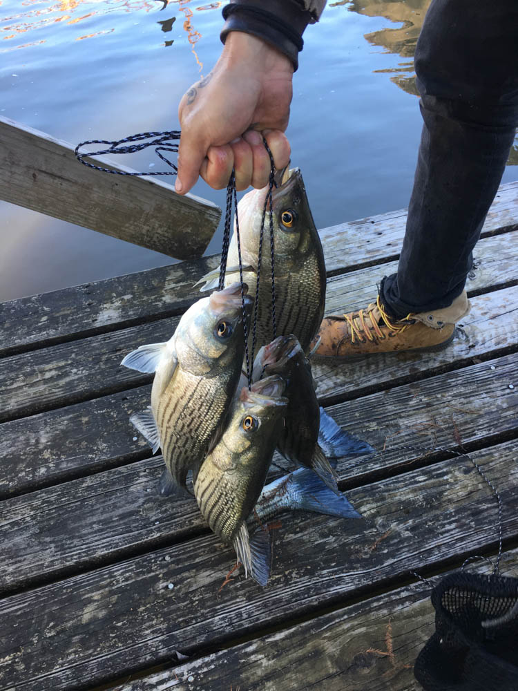 The Confederacy used the dam as part of its defense system during the Civil War. Three dozen Indian mounds were noted along the River when it was mapped in the early 1900s. (Eidse, “Voices of the Apalachicola.”) The Rock Bluff at Torreya State Park, a 150’ high ravine, is a stunning sight. Torreya trees that line the riverbanks are found almost nowhere else. The historic Jason Gregory House is worth stopping to see. The plantation home, built in 1849, was moved brick-by-brick from its original location on the lower west bank to the higher east bank of the Apalachicola. Recreational fishing on the River or its many creeks is a time-honored passion. Jim Mc- Clellan’s “Life Along the Apalachicola River” tells great stories of fishing for perch, bass, bream, shellcracker, channel catfish, crappie, and more. The Apalachicola River is a threatened treasure. I hope you can explore it soon.
Find out more:
On October 9th, Riverkeepers will sponsor RiverTrek 2018 to raise funds for river studies. Paddlers of all ages will embark on a five-day trip covering all 100+ miles of the River. The Riverkeepers also lead short paddling trips at various times. Call them at 850-653-8936 or see their website: www.apalachicolariverkeeper. org for more information.
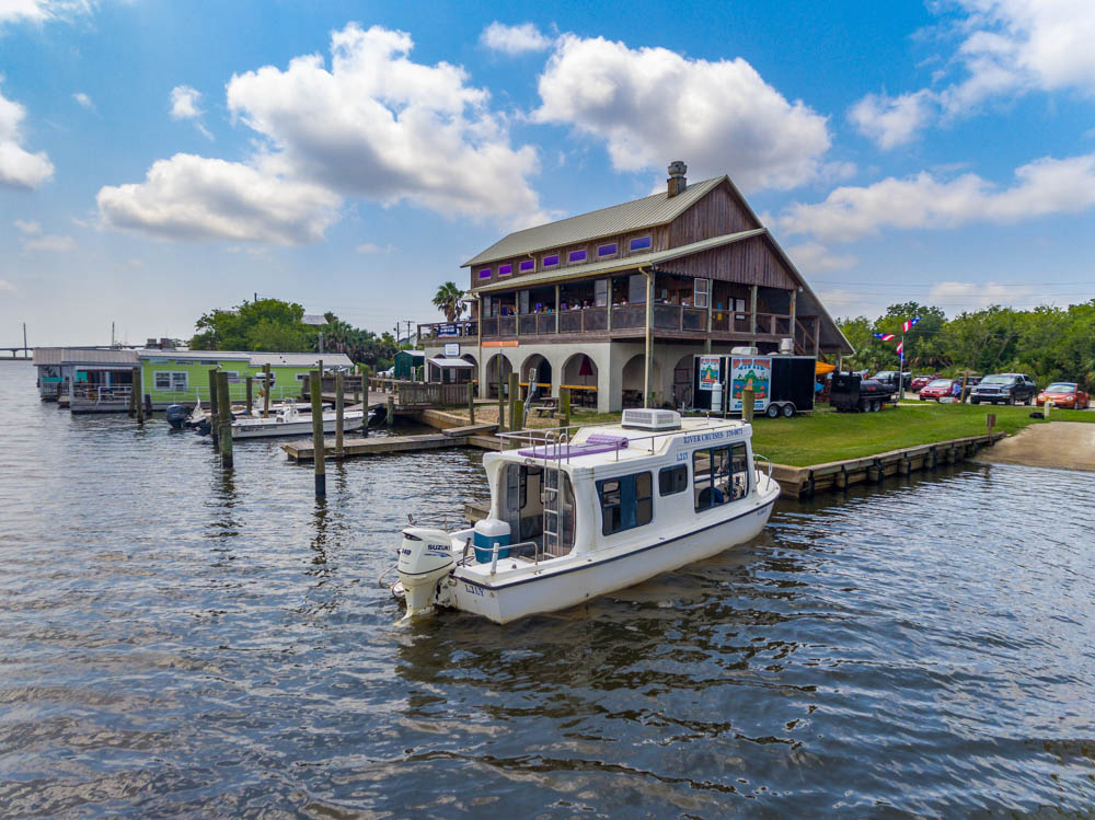
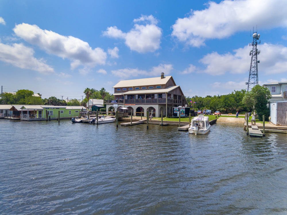
Or, take a private tour with Captain Gill Autrey. He has given tours for years and can be reached at 850-370-0075. Off the Map Expeditions in Wewahitchka at 850-819-3053 also offers tours. Tours of St. Vincent Island National Wildlife Refuge are offered by the Friends of St. Vincent Island.
See their website at stvincentfriends.com for additional information. Or arrange a trip to the Island aboard the St. Vincent Island Shuttle with Captain Joey by calling 850-229-1065.
Apalachicola Maritime Museum at 103 Water Street offers historical and recreational boat tours and events.
Call 850-653-2500 to confirm its opening times of 9:00 a.m. to 5:00 p.m., Tuesday through Saturday, or visit their website: ammfl.org for more information.
Apalachicola National Estuarine Research Reserve Nature Center, 108 Island Drive, Eastpoint. has good exhibits.
Find more on their website: www.apalachicolareserve.com.