THE MYSTERY OF ECONFINA’S NATURAL BRIDGE

BY ROBERT HURST PHOTOS BY RAY WISHART
“…he will come to a river which empties itself into Saint Andrews Bay. This river is crossed by a sort of Natural Bridge. As the river goes underground for some small distance, the place is known by the Indians by the name of Acouthinna [Econfina], which word in their language is a description of it.” Lieutenant Philip Pittman, circa 1767 (1)
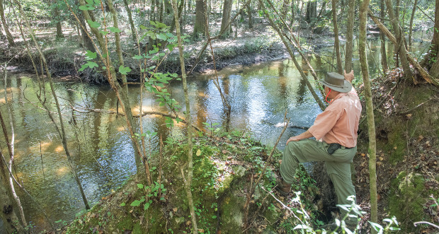
As visitors in Bay and Washington Counties enjoy the refreshing clear cold water of the many springs along the Econfina Creek, or marvel at the foliage and limestone along its shores, little do most realize that one of the wonders of the creek sadly has disappeared. This is the Natural Bridge. Its location is one of history’s mysteries. The very name Econ-fina derives from the Creek Indian word ekana (land, earth) and feno (bridge). This “earth bridge” or “natural bridge” was mentioned as early as the 1760s by British Lieutenant Phillip Pittman in his description of the route from Pas L’Este (East Point at Destin, FL) to “the Forks” (the confluence of the Chattahoochee and Flint Rivers).
Later, in 1823, Charles Vignoles’ Map of Florida labeled this particular anomaly “Natural Bridge of Rocks” as opposed to other such river crossings on the Chipola, Weechatemakee (Itchetucknee), or Santa Fe, where the designation is simply “Natural Bridge” or “here [the creek or river] runs subterraneous…” Perhaps, at least in the 1820s, the crossing may have been on large limestone “stepping stones” in the creek, in contrast to what is commonly found at other natural bridges where the stream’s flow runs underground. Possibly at even an earlier time, the creek did run underground, but by the 1820s the bridge may have collapsed and fragmented into limestone boulders lying in the creek bed.
“The Econfina river passes under a similar natural bridge, but it is narrow. The United States road from Pensacola to St. Augustine [Federal/ Military Road] crosses this bridge, but an addition of timber is now added.” John Williams, 1827 (2)
Williams may be referring to the bridge’s gradual deterioration. What eventually led to the final disappearance of the bridge may be due to logging, as was the case of others on the Chipola and St. Marks Rivers. Towering pine and cypress logs, some more than 300 years old, were rafted together and floated down rivers to nearby sawmills. Logging was probably done almost from the beginning of pioneer settlement, but the earliest recorded mill on St. Andrews Bay was the Washington Lumber Company, chartered in 1837, owners James and Harry Watson.(3) Natural bridges were an impediment to the flow of logs and navigation down streams, and probably led to the removal of such barriers. Evidence of log slides may still be seen along the Econfina.
“The Natural Bridge over the Econfina river of Bay County has long since disappeared, and recollection of its location appears to no longer linger in the memories of the inhabitants of the vicinity.” Mark Boyd, 1935 (4)
Unfortunately, as time passed, knowledge of the exact location of the bridge was lost. The wellknown Florida historian Mark F. Boyd noted this as early as 1935.
“The route I have chosen for the [Military] road commences at Deer Point and follows the old trail to the Cowford of Choctawatchee, thence direct to Ochessee Bluff on the Apalachicola river, crossing the Iconfinan [Econfina] at the Natural Bridge on that creek.” Captain Daniel Burch, 1823 (5)
In the early 1820s, the United States government and its Florida settlers desired a new road between Pensacola and St. Augustine, the two major cities of the newly acquired Territory of Florida. This undertaking was assigned to Captain Burch of the United States Army, and was built in the years 1824-26. The road went by many names, such as Burch’s Trace in the western part of the territory, and the Bellamy or St. Augustine Road in the east where it followed approximately the Old Spanish Trail (6); however the general name of the entire highway came to be called the Military Road (sometimes the Federal Road). Specifications called for a road with a 15-16 foot width. What appears left is a path probably no wider than 10 feet. On a roughly drawn circa 1827 map, titled “Sketch of the Florida Military and of the Post Road,” that appears to be an early commentary on the condition of the road, the segment between the Choctawhatchee and Apalachicola Rivers is labeled “not used” and the surrounding land labeled “no settlements.” In parts, the road is labeled “… not properly cut out.” It was reported that tree stumps were left in the roadbed, making travel difficult. Ferries and bridges were supposed to be established, but it was reported that these were few at best. The sketch map states that “the land is somewhat hilly, finely watered and requires bridges and fords, but sadly anything done.” It is quite clear from the correspondence between Burch and his superiors that the road crossed the Econfina at the Natural Bridge.
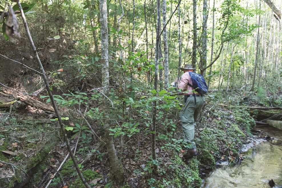
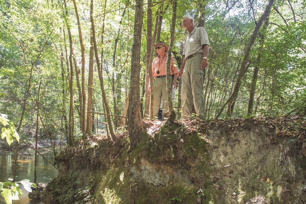
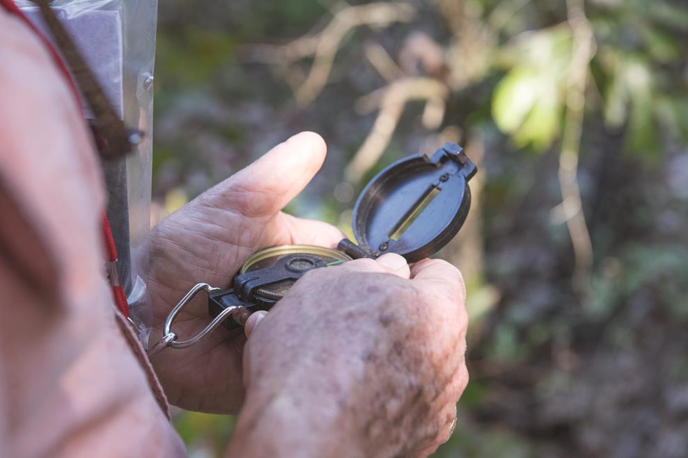
For several decades, Tom Bowen of Chipley and I have researched the route of this road, now out of use. Tom comes from an old Washington County pioneer family, and for many years has worked for the Department of Transportation in Chipley. Together, we have walked, photodocumented, and mapped existing segments of the road, from the white sandy “Andrew Jackson Path” in the Gulf Islands National Seashore Naval Live Oaks Area near Gulf Breeze to the shallow furrowed path in the pine lands and hard woods of Washington County. We have driven the wide canopied St. Augustine Road in Leon County and hiked the raised bed of the Bellamy Road across the Natural Bridge of the Santa Fe River in Oleno State Park. It was eventually replaced with later roads, such as the Holmes Valley Road, US90, and Interstate 10, in that order. With the aid of early maps, topographic maps, aerial photographs, early field survey notes, and other writings, we have mapped this road, perhaps more a trail, across much of the route, especially in the area between the Choctawhatchee and Apalachicola Rivers. Following this historic trail, it has led us to the approximate crossing at the Natural Bridge of the Econfina. Though the old footprint of the road has vanished at the nearest approach to the creek, enough of its remains are left further back, on each side of the stream, that an imaginary line, shown as dashes on the enclosed map) can be drawn connecting the two known segments, to reasonably plot the road’s course across the creek. At the probable intersection with the creek, there is evidence on the west bank of a limestone cliff and a dislodged limestone boulder. This is on the old Strickland property, now owned by family member Debbie Gay. On the opposite shore is only a low flood plain, leaving no evidence of a crossing. Any roadway or structure on this side has been washed away. Further east on a ridge between Jones’ Head and Adam’s Mill slough are faint tracings of the road, both on ground inspection and on aerial photographs of the years 1941 and 1953.
It is probable that the Natural Bridge disappeared circa 1830. The Florida Legislative Council mentioned a “Gainer Bridge,” rather than a Natural Bridge, in the 1830s. (7) Early settler William Gainer (great-great-grandfather of Bay County Commissioner George Gainer) and family constructed this bridge to the south of the old crossing. No doubt the height of the Natural Bridge’s west bank made it difficult to descend to the creek, and a new crossing had to be found downstream. This bridge lasted until July 21, 1864, when Union troops burned it along with Adam’s Mill.(8) Remains of the Gainer Bridge pilings are reported by Bay County resident Ken Thomas to have been visible as late as the 1970s. Presently, there are the remains of a 3 meter (approximately 10 feet) wide cut in the eastern limestone bank on the old John Douglas property, bearing evidence of Gainer’s crossing. There is also the impression on the Douglas grounds of the old roadbed. Gainer Bridge not only serviced the Military Road, but also was one of several crossings of the old Orange Hill/Chipley Road to St. Andrews Bay. Whether or not the bridge was restored is unknown, but a traveler in 1893 speaks of a “free ferry” in this vicinity.(9)
The site of the Natural Bridge across the Econfina River continued to be recognized on maps of Florida until 1843. Had these maps been more accurate, the site of the bridge would have been easily identified. Tom and I had hoped that locating the Natural and Gainer bridges would give us other coordinates to help plot the course of the Military and Chipley roads but actually in the case of the Natural Bridge, the reverse was true. The course of the road helped us find the bridge’s forgotten and assumed untraceable site.
FOOTNOTES
1. Lt. Philip Pittman, “Apalachee During the British Occupation,” Florida Historical Quarterly 12 (Jan. 1934), 118-19. 2. J. L. Williams, A View of West Florida (Philadelphia, 1827), 37. 3. E. W. Carswell, Washington, Florida’s First County (Tallahassee, 1991), 249-51; Tommy Smith, The History of Bay County from the Beginning (Panama City, 2000), 48; Harold W. Bell, Glimpses of the Panhandle (Chicago, 1961), 103. 4. Mark F. Boyd, “The First American Road in Florida,” Florida Historical Quarterly 14, no. 2 (Oct. 1936), 79. 5. ibid., 93. 6. See the soon to be published book The Spanish Trail, Travels Along Florida’s Royal Road, El Camino Real by Robert Hurst. 7. Marlene Womack, “Settlers Live and Die along Econfina Creek,” News Herald, Panama City, FL (July 17, 2008). 8. “Civil War,” Econfina Creek: Preserving Water Resource History (Northwest Florida Water Management District and Florida Humanities Council, n.d.), 16. 9. St. Andrews Buoy, St. Andrews, FL (May 4, 1893).